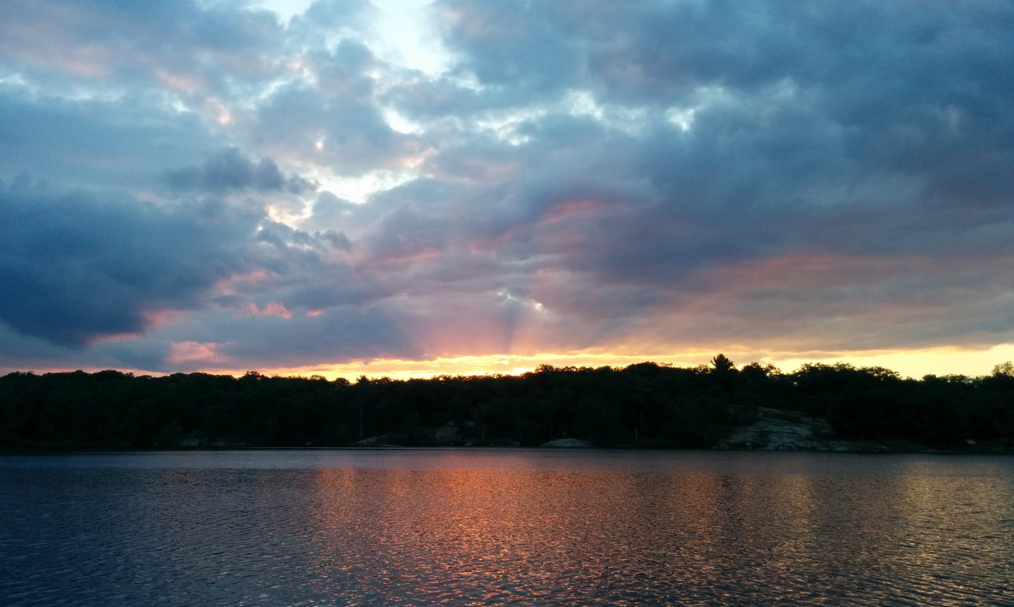
The past few years we have gone camping in Arrowhead Provincial Park on the Thanksgiving weekend to catch the fall colors. This year we knew the colors were not the best, so we decided to do something a little different. For Thanksgiving this year, we headed to Lake Placid in New York State. We have been here twice before, but the timing was lining up nicely with the fall color reports for the area.
Hiking Cascade Mountain
This report is a little backwards, as I do have a post for our activities on Saturday, but I really wanted to post this one first. Sunday morning we had awoke to lots of rain. We even had to hide out in a grocery store to wait out a torrential downpour that happened. We were prepping to hike one of the Adirondack High Peaks today, and this rain was a little bit of a damper on our plans. Finally after wandering around downtown the sun came out and we knew we had to get going.
There were reports on this trail head being altered just for this long weekend to help minimize the number of cars parked on the sides of the highway. We had known about this, but didn’t realize the actual magnitude of that change until we arrived at the NEW trail head. Below is the map of the new trail and temporary access. The yellow is the section that was added. If you follow the yellow trail to the regular black dotted lines, up to the word Cascade Mountain, you can see the length of this detour. Cascade Mountain is normally a 4 mile round trip. This yellow section added an EXTRA 5 miles!! We would be hiking 9 miles today! That’s just about 12 km for us Canadian folk.
We committed to the fact that this may just take us 5-6 hours, not the 2-3 hours. Good thing we didn’t start any later in the day.

Along the new trail, we pass through plots of private land where the owners were generous enough to allow access for this weekend. We had the privilege of seeing a huge maple syrup collection all set up. It looked like huge spider webs from far away.

I like seeing different trail markers in different areas, and this one politely says Foot Trail. I did see three people biking on the new trail, but guess in this section they are not suppose to travel.

I didn’t take many pictures on the way up, and I mean UP UP UP. It seemed like we were climbing elevation the entire time from the parking lot. I did take a picture of the marker for Porter Mountain peak. It is ONLY 0.7 miles (one way). I don’t think that was going to happen, meaning we would only complete one high peak on this particular trek.

As you get out towards the summit of Cascade, the trees disappear, and you are left with wide open granite. It was amazing, even from this vantage point. There were rock cairns guiding your way to the summit.

I tend to notice little things on the trail, and this geodetic survey marker is something I’ve seen on many hikes. There are a number of these on the Signal Hill hike in Newfoundland. I did think of home when I saw this.

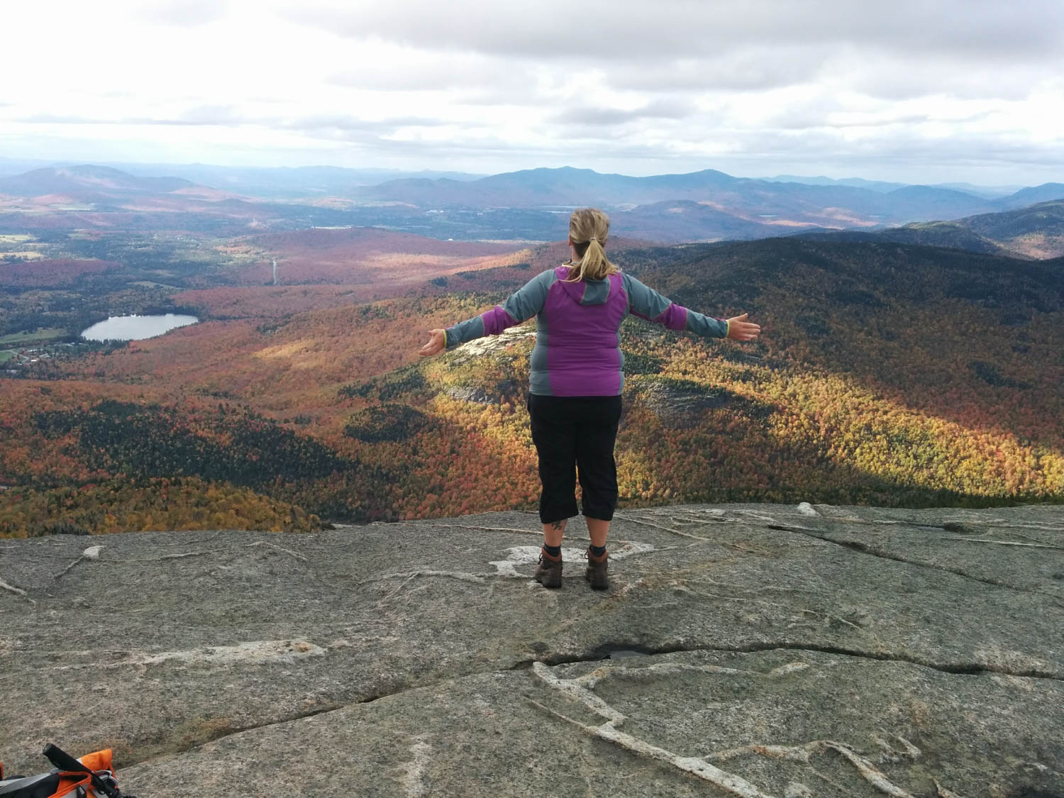
Once I decided to actually look up, after staring at the ground for so long as we climbed higher and higher, we were greeted with the most wonderful view! There were valleys and peaks all around us, with the trees glowing red, orange, and yellow. It was amazing!

I had to have my little helper take this next picture for me 🙂 There was actually a series of photos Hayden took, but this was the best. I was taking in the smells, the crisp air, the colors, and I didn’t want to leave.


Being so windy, Hayden decided to wander around and found this crack in the rock to hide out while we both took pictures. Pretty good idea if you ask me. Although I would not want to stay on the top of this peak overnight. You just might blow away.

There was one thing I was not expecting to see, and that was a sign with “privy” on it. Who knew that the people that look after this area installed a couple of these thunderboxes?! It was actually convenient, since we all had to make that pit stop before heading back down the trail.

During the decent, I saw a few of these trees that had markings on them. I wonder if they are actual trail marking, or was someone not being nice. I will wish for the trail marking option.

At the bottom, finally, our legs were done. We had been hiking for roughly 5 hours, covering just over 12 km. This means we have completed 1 of 46 high peaks in the Adirondacks. Not sure if we will go back to attempt another peak, but right now the hot tub in the hotel was calling our names.
Have you hiked any of the high peaks? Are there other ones you would recommend? I would love to hear about it.